The first written report dates back to 1542. The village is located at an altitude of 567 metres. The village includes cultural monuments, especially monuments of folk architecture, cycling and skiing routes. There is a volunteer fire brigade.
The first written report dates back to 1662. The village is situated at an altitude of 675 metres. Provision of Czech POINT services. There is a memorial of the Partisan Brigade.
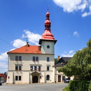
The first written report dates back to 1454. The village is located at an altitude of 628 metres. Provision of Czech POINT services. The dominant feature of the village is the Chapel of St. Rosalie.
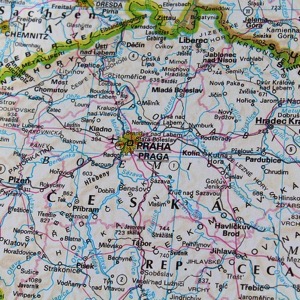
The village of Kuklík is located in the Žďár nad Sázavou district near Nové Město na Moravě at an altitude of 650 metres. 195 inhabitants live on the territory.
The first written report dates from 1349. The town is located at an altitude of 309 metres. The town includes schools, a salvage yard and landfill, monuments, a nursery, various clubs and centres.
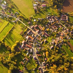
First written record from 1131. Altitude 260 m above sea level, 1400 inhabitants. The village consists of the local parts of Rosice, Synčany, Brčekoly and Bor u Chrosutovic. In the village there is a kindergarten, primary school, doctors, grocery stores, drugstore, butcher's shop, bakery, minimill, distillery. There are SDH, TJ Dynamo, Senior Citizens Club, markets on Saturdays.
The first written report dates back to 1377. The village is located at an altitude of 580 metres. Every year our village organizes many social, cultural and sporting events.
The first written report dates back to 1530. The village is located at an altitude of 498 meters. There are 140 inhabitants. Provision of Czech POINT services. We run a volunteer fire brigade. There is a sports ground in the village for leisure time.
The first written report dates back to 1265. The village is located at an altitude of 575 metres. In the village you can find the church of St. George, the Marian chapel, the ossuary or the chapel of the Holy Trinity. We organize tournaments, competitions, concerts and other social and cultural events.
The first written report dates back to 1319. The village is located at an altitude of 485 meters. The Bijavický brook flows through the village. There are two ponds in the wooded area of Mastník. Provision of Czech POINT services.