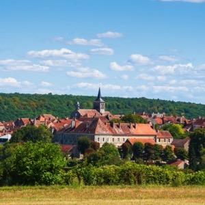
The first written report dates back to 1352. The village is located at an altitude of 206 metres. It is important for breeding Old Cladrucian horses. Since 2019, it has a UNESCO World Heritage Site (National Stud Farm) on its territory,
The first written report dates back to 1086. The town is situated at an altitude of 212 metres. There are 9019 inhabitants in the territory. Provision of Czech POINT services. Part of the village is the church of St. James the Greater. There are kindergartens, primary and secondary schools, a primary art school, a library and a sports ground.
Information about the office and cultural and social events of the municipal district, which includes the municipalities of Lány na Důlku, Opočínek, Popkovice, Staré Čívice and Svítkov. Provision of CzechPOINT services.
Information about the office and cultural and social events of the municipal district, which includes the municipalities of Doubravice, Ohrazenice, Rosice nad Labem, Semtín and Trnová. Provision of CzechPOINT services.
Information about the office and cultural and social events of the municipal district, under which the Cihelna and Polabiny municipalities fall. Provision of CzechPOINT services.
Information about the office and cultural and social events of the municipal district, which includes the municipal parts of Dražkovice, Dukla, Nové Jesenčany and Zelené Předměstí. Provision of CzechPOINT services.
Information about the office and cultural and social events of the municipal district, which includes the municipal parts of Bílé Předměstí, Staré Město, Zámek and Zelené Předměstí. Provision of CzechPOINT services.
The region takes care of the comprehensive development of the territory and the needs of its citizens, in particular, the creation of conditions for the development of social welfare, the satisfaction of the need for the protection and development of healthy living conditions, education and training, culture and the protection of public order.
The first written record dates back to 1325. The village is located at an altitude of 229 metres. A marked cycle route passes through the village. A municipal newsletter is published. We organize social and cultural events.
The first written report dates back to 1352. The village is located at an altitude of 284 metres. 67 inhabitants live on the territory. The surrounding area is suitable for cycling and hiking. There is a chapel in the village.