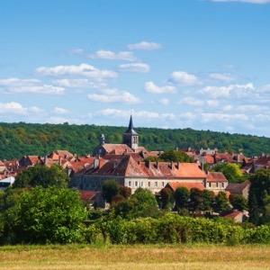
The first written report dates back to 1374. The village is located at an altitude of 530 metres. An interesting feature of the village is the chapel dedicated to the Holy Trinity.
The first written report dates back to 1303. The town is located at an altitude of 273 metres. Provision of Czech POINT services. In the surroundings there is Častolovice Castle, Doudleby nad Orlicí, Potštejn Castle and Opočno Castle.
The first written record dates back to 1261. The town is situated at an altitude of 296 metres. The Vizovice Castle is located in the town. The Masters Of Rock festival is regularly held here. There is a kindergarten, primary, secondary and practical school.
The first written report dates back to 1285. The town is located at an altitude of 340 metres. We organize cultural and social events. Provision of Czech POINT services.
The first written record dates back to 1331. The village is located at an altitude of 487 metres. In the village there is a primary and kindergarten, a sports complex, a racecourse, a community centre, a grocery store, a restaurant and a guesthouse.
The first written record dates back to 1389. The village is located at an elevation of 650 meters. It has a population of 46. The village lies on the border of the Šumava Protected Landscape Area. The Blanice River flows in its immediate vicinity. The village’s panorama is dominated by views of the Boubín and Bobík mountains.
The first written report dates back to 1295. The village is located at an altitude of 387 metres. Provision of Czech POINT services. In the village there is a recreation area and a castle.
The first written report dates back to 1254. The town is situated at an altitude of 378 metres. The territory has 29 720 inhabitants. Provision of Czech POINT services. In the town there is a stone bridge from the 13th century, a provincial stud farm, the dean's church of the Virgin Mary's birth and other monuments.
Information about the office and cultural and social events of the municipal district, which includes the municipalities of Černá za Bory, Drozdice, Mnětice, Nemošice, Pardubičky, Staročernsko and Žižín. Provision of CzechPOINT services.
The first written record dates back to 1261. The village is situated at an altitude of 364 metres. There are 510 inhabitants. There is a kindergarten and a primary school in the village.