We offer design and engineering activities in construction. We provide architectural studies, building permit processing and building supervision. We provide consultancy.
I offer engineering and design activities in the construction industry. Provide project documentation, computer visualization, building permit documents, construction supervision and more.
We offer geodetic and cartographic works. We carry out land development, processing of documentation of the actual execution of buildings, delineation of the spatial position of linear buildings, residential and administrative buildings, utilities and houses. We focus utility networks. We provide consultancy.
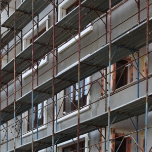
Offer comprehensive services in the field of civil, transportation and engineering construction. Our main focus is to provide technical supervision of the investor and HSE coordinator. We are able to provide the preparation of project documentation, including a bill of quantities, engineering activities and tender for the construction contractor.
We provide surveying work. We offer geometric plans, plot boundary marking, mapping for design and surveying of completed buildings. We provide surveying of the laying of utilities with digital processing according to the regulations of the administrators, determination of the cubature of bulk material dumps and more.
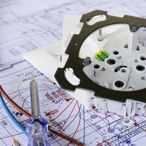
I run a design office. I offer engineering services, preparation of project documentation, expert studies and reports, cost control during construction, construction and technical supervision. I also arrange the necessary building permits. I realize 3D visualizations.
Provide surveying work and electrical design for buildings. We provide programming and professional consulting in the field of geographic information systems. We carry out urban mapping and land use plans. We also offer preparation of expert opinions, creation or establishment of easements.
We carry out surveying work and land development. We specialize in measuring and evaluating vertical and horizontal displacements of building objects and deformations. We perform creation of base maps, digitization of siding plans. We prepare map documents for the project and delineate the spatial position of the construction.
We are an architectural and engineering firm providing services in the areas of design and engineering in the construction industry, including the construction of buildings.
The firm provides land surveying services for land registration, design, construction, engineering surveying and land authorities. We focus on cities, towns, municipalities and businesses.