Geodetic work - geometric plans, surveying of buildings, land and utilities, project documents, deformation measurements and more. Useful surveying services for property owners, developers, designers and builders.
We provide engineering surveying, photogrammetry and plotting of buildings, land and land development. We produce geometric plans, accurate GPS positioning, digital maps and construction documentation. We deal with measuring and calculating displacements or drawing digital models of terrain and engineering objects.
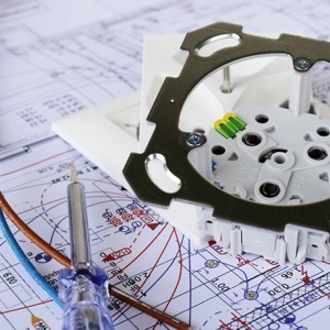
We provide comprehensive design services and engineering for modern energy. We deal with electrical design, design of photovoltaic power plants, battery storage, carports and agrovoltaics. We will prepare the project documentation, arrange communication with the authorities on your behalf, and even arrange building permits.
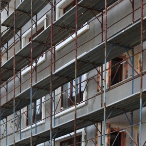
We carry out building renovations, turnkey new builds, civil and industrial construction and demolition work. We offer original projects, preparation of project documentation, architectural designs, identification of suitable sites. We also provide production preparation, consulting and expert advice.
We carry out surveying work in construction and cadastre, geometric plans, property boundary marking, building demarcation, documentation of actual construction, purpose maps and project documents. Development and real estate activities. We work throughout the whole territory of the Czech Republic.
Providing a full range of design, inspection and consultancy services for lightning and surge protection. We carry out inspections on an exceptional basis as approximately 95% of lightning protection systems are substandard, unfortunately this also applies to internal protection. Most of the time the owner only finds out when the insurance company refuses to pay for the damage.
Providing supplies, projects, services and engineering in the field of automation and industrial process control. We supply analysers, chromatographs, analysis houses, gas detection, measurement and control, camera systems, fire and gas detection. We manufacture switchboards. Programming of control systems.
We provide complete design and engineering activities in construction for all types of civil buildings - apartment houses, family houses and other buildings.
We offer consultancy in the field of production and construction. Development of information systems. Programming or Access training.
I offer custom metal fabrication. I provide design and engineering services. I provide fabrication and design of single purpose machinery and equipment for automotive or general locksmithing products. I create 2D and 3D design and construction work in engineering and construction.