Providing services in vectorization and creation of 3D models or conversion of paper documentation into digital form. Supply of large format printers. We create 3D interactive landscape visualizations, mine survey documentation, design mineral extraction and mitigation.
We can help you choose barcode and 2D barcode scanners, warehouse terminals, label printers, shop equipment, RFID and much more. We stock a large selection of consumables for label printers and RFID. We are an authorized service center for CipherLab, Opticon, TSC, Zebex, Birch brand equipment.
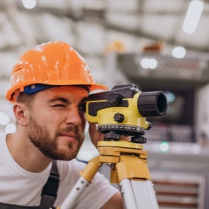
We supply cutting-edge measurement technology for surveying, construction, industry, architecture and agriculture. We offer solutions for 3D scanning, UAV and precise field measurement and data processing. We are the official representative of DJI, SOKKIA, TOPCON, FARO, NIVEL System and other brands.
Internet sales of measuring equipment and technology in the field of surveying, construction, industry, agriculture and generally wherever there is a need to measure. We are the official representative of several major brands in the industry, such as the Japanese brand SOKKIA, DJI, FARO, NIVEL system, GeoSLAM, etc.
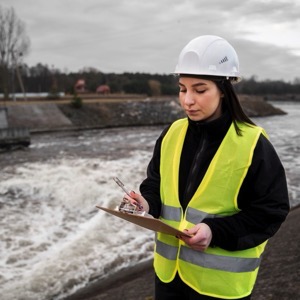
We are engaged in surveying work in land registry and engineering surveying. The subject of our activity is the creation of geometric plans, easements, delineation of land boundaries. In the field of engineering geodesy, we carry out surveying on construction sites and the creation of all geodetic documentation of buildings.
We are modern construction technology professionals with years of experience in deploying and supporting construction digitization, CDE, BIM, GIS, FME and asset management.
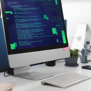
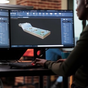
We supply CAD/CAM, BIM, GIS/FM, PDM/PLM solutions, design software for engineering and construction - AutoCAD, Inventor, Revit, Map, Civil 3D, Vault, Fusion 360, BIM 360, 3ds Max. We offer custom development of CAD applications. Autodesk training center. Technical support and implementation of CAD/BIM/PDM programs.
We offer 3D scanning, VR application and game development, virtual reality. We provide 3D scanning services (objects, buildings, environments, monuments, people). We develop applications and games for virtual reality.
Providing services in vectorization and creation of 3D models or conversion of paper documentation into digital form. Supply of large format printers. We create 3D interactive landscape visualizations, mine survey documentation, design mineral extraction and mitigation.
Engineering surveying and land registry company. Construction documents and laser scanning are no problem for us. We produce geometric plans or map documents for the construction of a new house. We carry out the delineation of linear and ground structures.
Data collection using drones, mobile mapping systems and laser scanning. We provide BIM documentation, 3D documentation of buildings and structures, cubature monitoring and mapping. We offer comprehensive services in geoinformatics, geomatics and engineering surveying.
Our specialty is 3D design of new and conversion of existing states of engineering units, structures and their components. We provide the creation of drawings and element libraries. We are engaged in the creation of catalogues (specifications) for piping and steel components.