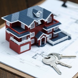
We are engaged in surveying work in land registry and engineering surveying. The subject of our activity is the creation of geometric plans, easements, delineation of land boundaries. In the field of engineering geodesy, we carry out surveying on construction sites and the creation of all geodetic documentation of buildings.
If you need surveyors, you can contact us. We will send you a quotation and a possible date of realization of the contract. We work accurately, quickly and at reasonable prices. We provide comprehensive services in surveying.
I offer professional geodetic work - building surveying, geometric plan for house or extension approval, plot boundary delineation, building passport, land surveying, position and height survey, owner's declaration. Photo and video documentation. Free dates for surveying, contact me for a quotation
Comprehensive service in geodesy and cadastre. Geometric plans for approval, land division, boundary refinement, easements, etc. Delineation of boundaries. Delineation of buildings. Surveying of the actual design. Surveying of water and sewage connections. We will prepare a passport of the construction for you. Owner's declaration.
We carry out all geodetic work, preparation of documentation Digital Technical Map. We make geometric plans, documentation of buildings and boundary marking. We survey utility networks, map documents, actual condition of buildings for reconstruction, we offer OG activities and preparation of expert reports and consultations.
We carry out all geodetic work, preparation of documentation Digital Technical Map. We make geometric plans, documentation of buildings and boundary marking. We survey utility networks, map documents, actual condition of buildings for reconstruction, we offer OG activities and preparation of expert reports and consultations.
We offer comprehensive surveying work for buildings and land. We provide geometric plans for registration in the Land Registry (new construction, land transfer, easements), delineation of land boundaries, mapping (semi-althography, altimetry), delineation of buildings, surveying of buildings and houses for approval and laser scanning.
We carry out all surveying work. We specialise in the delineation and surveying of utilities, especially gas pipelines. We also offer plotting and surveying of the actual construction of all buildings for approval. Furthermore, we provide documentation for projects. And also land boundary marking and geometric plans.
We offer comprehensive surveying services in Prague and the Central Bohemia Region. We prepare geometric plans, land and building surveys, documentation of the actual execution of buildings and all map documents.
Surveying work - surveying and delineation of buildings and land from the land registry and in the construction industry - geometric plans, map documents, special surveying.
We provide a full range of services mainly in the following areas: engineering geodesy, mapping, cadastre, land development design, laser scanning, photogrammetry, UAV, geographic information systems, information systems integration, mobile applications for geoinformatics and others.
We carry out surveying activities - geometric plans for the Land Registry, delineation of property boundaries, surveying of easements. Engineering surveying - delineation and surveying of buildings, surveying and preparation of special purpose maps, elevations, documents for projects.