List of businesses
CheckTerra s.r.o.

CheckTerra s.r.o.

  • Aerial photography and videography
Tyršovo náměstí 162, Hostomice
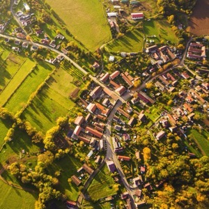
Data collection using drones, mobile mapping systems and laser scanning. We provide BIM documentation, 3D documentation of buildings and structures, cubature monitoring and mapping. We offer comprehensive services in geoinformatics, geomatics and engineering surveying.
South Drones, s.r.o.

South Drones, s.r.o.

  • Aerial photography and videography
Stráž nad Nežárkou, Dvorce 7
We provide aerial photography and drone filming including processing of acquired data into 2D maps, 3D models including revisions and inspection.
TopGis, s.r.o.

TopGis, s.r.o.

2 reviews
  • Geographic information systems
Svatopetrská 35/7, Brno, Komárov
We specialize in aerial surveying, mobile mapping, passporting, geoinformation services and analysis, web mapping portals and geomarketing. We provide services for property owners.
G4D

G4D

1 review
  • Software development
Hauptova 594, Praha, Zbraslav
Closed · opening today at 8:00
We are top specialists in unmanned interior and exterior inspections, terrestrial and mobile 3D laser scanning, building passporting and 3D information models (BIM). Virtual tours including VR and AR. We sell 3D reconstruction software and also develop custom solutions. All this since 2011.
TKP geo s.r.o.

TKP geo s.r.o.

  • Surveyors
Měšická 2697, Tábor
We provide a full range of services mainly in the following areas: engineering geodesy, mapping, cadastre, land development design, laser scanning, photogrammetry, UAV, geographic information systems, information systems integration, mobile applications for geoinformatics and others.

We display results 1519 of total 19 found

with tag Ortofotomapy at Czech Republic.